
File:Canada (orthographic projection).svg

Size of this PNG preview of this SVG file: 541 × 541 pixels. Waxyaabaha kale xalinta: 240 × 240 pixels | 480 × 480 pixels | 768 × 768 pixels | 1,024 × 1,024 pixels | 2,048 × 2,048 pixels.
Faylka asalka ah (SVG file, nominally 541 × 541 pixels, file size: 487 KB)
Qoraal kooban
| Sharaxaad |
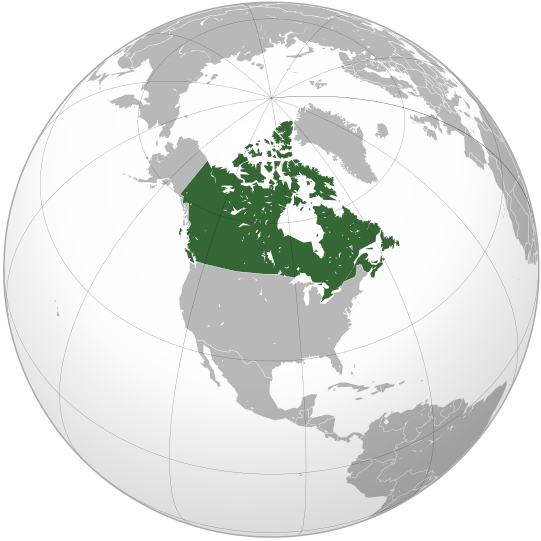
English: Map of Canada |
||||
| Taariikhda | |||||
| Xigasho |
Shaqadayda (Original text: Own work,)
|
||||
| Qoraa | Ssolbergj | ||||
| Other versions |
Derivative works of this file: Map of New Brunswck.png .svg)
|
||||
| SVG genesis |

.svg)
.svg)
.svg)
.svg)
.svg)
.svg)
.svg)
.svg)
.svg)
.svg)
.svg)
.svg)
.svg)
.svg)
.svg)
.svg)
.svg)
.svg)
.svg)
.svg)
.svg)
.svg)
.svg)
.svg)
.svg)
.svg)
.svg)
.svg)
.svg)
.svg)
.svg)
.svg)
.svg)
.svg)
.svg)
.svg)
.svg)
.svg)
.svg)
.svg)
.svg)
.svg)
.svg)
.svg)
.svg)
.svg)
.svg)
.svg)
.svg)
.svg)
.svg)
.svg)
.svg)
.svg)
.svg)
.svg)
.svg)
.svg)
.svg)
.svg)
.svg)
.svg)
.svg)
.svg)
.svg)
.svg)
.svg)
.svg)
.svg)
.svg)
.svg)
.svg)
.svg)

.svg)

.svg)

.svg)
.svg)
.svg)
.svg)
.svg)
.svg)
.svg)


.svg)
.svg)
.svg)
.svg)
.svg)
.svg)
.svg)

.svg)
.svg)
.svg)
.svg)
.svg)
.svg)
.svg)
.svg)
.svg)

.svg)
.svg)
.svg)
.svg)
.svg)
.svg)
.svg)
_without_national_boundaries.svg)
.svg)
.svg)
.svg)
.svg)
.svg)
.svg)

.svg)
.svg)
.png)
.svg)
.svg)
.svg)
.svg)

.svg)
.svg)
.svg)
.svg)
.svg)
.svg)
.svg)
.svg)
.svg)
.svg)
.svg)

.svg)
.svg)
.svg)
.svg)
.svg)
.svg)
.svg)
.svg)
.svg)

.svg)
.svg)

.svg)
.svg)
.svg)
.svg)
.svg)
.svg)
.svg)
.svg)
.svg)
.svg)
.svg)
.svg)
.svg)
.svg)
.svg)
.svg)
.svg)
.svg)
.svg)
.svg)
.svg)
.svg)
.svg)
.svg)
.svg)
.svg)
.svg)
_-_Crimea_disputed.svg)
.svg)
.svg)
.svg)
.svg)
.svg)
.svg)
.svg)
.svg)
.svg)
.svg)
.svg)
_political.svg)
.svg)
.svg)
.svg)
.svg)
_-_Crimea_disputed_-_no_borders.svg)
.svg)
.svg)
.svg)
.svg)
.svg)
.svg)
.svg)
.svg)
.svg)
.svg)
.svg)

.svg)
.svg)
.svg)

.png)
.svg)
.svg)
.svg)
.svg)
.svg)
.svg)
.svg)
.svg)
.svg)
.svg)
.svg)
.svg)
.svg)
.svg)
.svg)
.svg)
.svg)
.svg)
.svg)
.svg)
.svg)
.svg)
.svg)
.svg)
.svg)
.svg)
.svg)
.svg)
.svg)
.svg)
.svg)
.svg)
.svg)
.svg)
.png)
.svg)
.svg)
.svg)
_(orthographic_projection).png)
.svg)
.svg)
.svg)
Laysinka
I, the copyright holder of this work, hereby publish it under the following license:
|cc-by-3.0}}🐸
Taariikhda faylka
Riix taariikhda/waqtiga si aad u argto faylka sida oo ahaa markiisa hore.
| Taariikhda/Waqtiga | Sawir yar | Cabirka | Isticmaale | Ka hadalka | |
|---|---|---|---|---|---|
| kan hadda | 17:00, 29 Oktoobar 2008 | | 541 × 541 (487 KB) | Ssolbergj | {{Information |Description={{en|1=Map of Canada}} |Source=Own work by uploader |Author=Ssolbergj |Date=29 October 2008 |Permission= |other_versions= }} <!--{{ImageUpload|full}}--> Category:Orthographic projections [[Category:Ma |
Faylka lagu isticmaalay
waxyaabaha soo socda ee bog ayaa adeegsanaya faylkaan:
isticmaalka faylka aduunka
Wikisyada kale ee soosocda ayaa adeegsanaya faylka:
- Ku isticmaal ady.wikipedia.org
- Ku isticmaal af.wikipedia.org
- Ku isticmaal af.wiktionary.org
- Ku isticmaal als.wikipedia.org
- Ku isticmaal ang.wikipedia.org
- Ku isticmaal arc.wikipedia.org
- Ku isticmaal ar.wikipedia.org
- Ku isticmaal as.wikipedia.org
- Ku isticmaal az.wiktionary.org
- Ku isticmaal bcl.wikipedia.org
- Ku isticmaal be-tarask.wikipedia.org
- Ku isticmaal beta.wikiversity.org
- Ku isticmaal be.wikipedia.org
- Ku isticmaal be.wiktionary.org
- Ku isticmaal bg.wikipedia.org
- Ku isticmaal bm.wikipedia.org
- Ku isticmaal bo.wikipedia.org
- Ku isticmaal br.wikipedia.org
- Ku isticmaal ceb.wikipedia.org
- Ku isticmaal chr.wikipedia.org
- Ku isticmaal chy.wikipedia.org
- Ku isticmaal ckb.wikipedia.org
- Ku isticmaal crh.wikipedia.org
- Ku isticmaal cs.wikipedia.org
- Ku isticmaal cs.wikiquote.org
- Ku isticmaal cu.wikipedia.org
- Ku isticmaal cv.wikipedia.org
- Ku isticmaal da.wikipedia.org
- Ku isticmaal de.wikipedia.org
- Ku isticmaal dv.wikipedia.org
- Ku isticmaal el.wikipedia.org
- Ku isticmaal eml.wikipedia.org
- Ku isticmaal en.wikipedia.org
View more global usage of this file.
.svg)
.svg)