
File:Ägypten Tal der Könige.jpg
Cabirka muuqaalkaan: 800 × 600 pixels. Waxyaabaha kale xalinta: 320 × 240 pixels | 640 × 480 pixels | 1,024 × 768 pixels | 1,280 × 960 pixels | 2,560 × 1,920 pixels.
Faylka asalka ah (2,560 × 1,920 pixels, weyninka faylka : 2.62 MB, nuuca MIME: image/jpeg)
Qoraal kooban
| Sharaxaad |
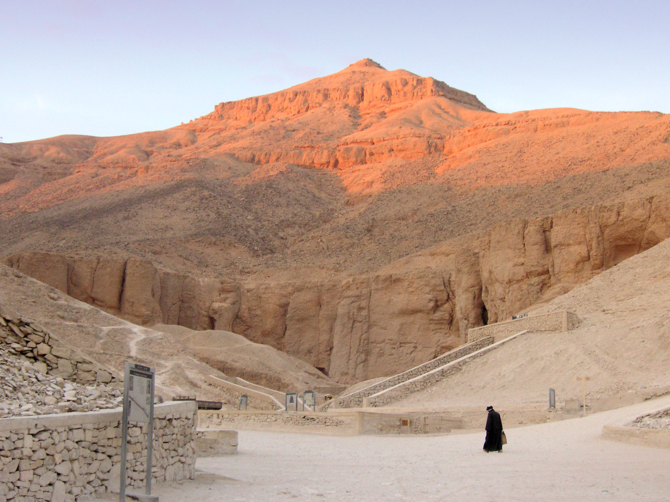
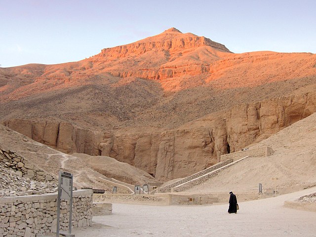
Deutsch: Tal der Könige bei Luxor, Ägypten.
English: Valley of the Kings near Luxor, Egypt.
Français : La Cime, en arabe Al-Qurn, domine la vallée des rois. |
| Taariikhda | |
| Xigasho | Own work by Nikater. |
| Qoraa | User:Nikater |
| Camera location | | View this and other nearby images on: OpenStreetMap |
|---|
Laysinka
I, Nikater, the copyright holder of this work, hereby publishes it under the following licenses:

|
Permission is granted to copy, distribute and/or modify this document under the terms of the GNU Free Documentation License, Version 1.2 or any later version published by the Free Software Foundation; with no Invariant Sections, no Front-Cover Texts, and no Back-Cover Texts. A copy of the license is included in the section entitled GNU Free Documentation License. |
This file is licensed under the Creative Commons Attribution-Share Alike 3.0 Unported, 2.5 Generic, 2.0 Generic and 1.0 Generic license.
Attribution: I, Nikater
- Waad fasaxantahay:
- la wadaagid – koobi gareenta, qaybinta iyo gudbinta shaqada
- to remix – in shaqada la waafajiyo
- Shuruudaha soo socda:
- Astaan – You must give appropriate credit, provide a link to the license, and indicate if changes were made. You may do so in any reasonable manner, but not in any way that suggests the licensor endorses you or your use.
- si isku mid la wadaag – If you remix, transform, or build upon the material, you must distribute your contributions under the same or compatible license as the original.
You may select the license of your choice.
Taariikhda faylka
Riix taariikhda/waqtiga si aad u argto faylka sida oo ahaa markiisa hore.
| Taariikhda/Waqtiga | Sawir yar | Cabirka | Isticmaale | Ka hadalka | |
|---|---|---|---|---|---|
| kan hadda | 09:10, 27 Agoosto 2007 | | 2,560 × 1,920 (2.62 MB) | Nikater | {{Information |Description=Valley of the Kings near Luxor, Egypt. |Source=Own work by Nikater. |Date=27 August 2007 |Author=User:Nikater |Permission=see below }} |
Faylka lagu isticmaalay
waxyaabaha soo socda ee bog ayaa adeegsanaya faylkaan:
isticmaalka faylka aduunka
Wikisyada kale ee soosocda ayaa adeegsanaya faylka:
- Ku isticmaal af.wikipedia.org
- Ku isticmaal ar.wikipedia.org
- Ku isticmaal ba.wikipedia.org
- Ku isticmaal ca.wikipedia.org
- Vall dels Reis
- Howard Carter
- Eduard Toda i Güell
- Vall dels nobles
- Vall de les Reines
- Karl Richard Lepsius
- Jean-François Champollion
- Giovanni Battista Belzoni
- Usuari:Xbosch
- Usuari Discussió:Luna92
- Lord Carnarvon
- KV62
- KV5
- KV34
- Plantilla:Vall dels reis
- KV57
- Llista de tombes de la Vall dels Reis
- El-Qurn
- TT320
- KV35
- KV17
- Victor Loret
- KV23
- KV20
- KV7
- KV1
- KV2
- KV3
- James Burton
- Theban Mapping Project
- Otto Schaden
- Theodore M. Davis
- KV4
- KV6
- KV8
- KV9
- KV10
- KV11
- KV12
- KV13
- KV14
- KV15
- KV16
- KV18
- KV19
- KV21
- KV22
View more global usage of this file.