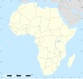
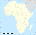
File:Africa location map.svg

Size of this PNG preview of this SVG file: 635 × 600 pixels. Waxyaabaha kale xalinta: 254 × 240 pixels | 508 × 480 pixels | 813 × 768 pixels | 1,084 × 1,024 pixels | 2,169 × 2,048 pixels | 1,525 × 1,440 pixels.
Faylka asalka ah (SVG file, nominally 1,525 × 1,440 pixels, file size: 774 KB)
Taariikhda faylka
Riix taariikhda/waqtiga si aad u argto faylka sida oo ahaa markiisa hore.
| Taariikhda/Waqtiga | Sawir yar | Cabirka | Isticmaale | Ka hadalka | |
|---|---|---|---|---|---|
| kan hadda | 12:40, 2 Oktoobar 2012 |  | 1,525 × 1,440 (774 KB) | Palosirkka | Reverted to version as of 19:13, 14 July 2011 Location maps must remain very accurate |
| 20:15, 12 Sebteembar 2012 |  | 1,525 × 1,440 (524 KB) | Palosirkka | Scrubbed with http://codedread.com/scour/ | |
| 19:13, 14 Luuliyo ama Luulyo 2011 |  | 1,525 × 1,440 (774 KB) | Sting | Sudan/South Sudan 2011-07 border update | |
| 20:12, 2 Luuliyo ama Luulyo 2010 |  | 1,525 × 1,440 (573 KB) | Sting | == {{int:filedesc}} == {{Location|00|00|00|N|15|00|00|E|scale:30000000}} <br/>{{Information |Description={{en|Blank administrative map of political Africa, for geo-location purposes.}} {{fr|Carte administrative vierge de l'[[:fr:Afrique|Afr |
Faylka lagu isticmaalay
waxyaabaha soo socda ee bog ayaa adeegsanaya faylkaan:
isticmaalka faylka aduunka
Wikisyada kale ee soosocda ayaa adeegsanaya faylka:
- Ku isticmaal af.wikipedia.org
- Ku isticmaal als.wikipedia.org
- Ku isticmaal an.wikipedia.org
- Alcher
- Addis Abeba
- Brazzaville
- Accra
- Buyumbura
- Abuja
- Chibuti (ciudat)
- N'Djamena
- Banjul
- Lilongwe
- Bamako
- Maseru
- Kigali
- Asmara
- Mbabane
- Bissau
- Bangui
- Plantilla:Mapa de localización Africa
- Victoria (Seychelles)
- Freetown
- Moroni
- Sant Tomé
- Saint-Denis (Reunión)
- Saint-Benoît (Reunión)
- Saint-Paul (Reunión)
- Saint-Pierre (Reunión)
- Mamoudzou
- Ku isticmaal ar.wikipedia.org
- ابن بطوطة
- الألعاب الإفريقية
- قالب:خريطة مواقع إفريقيا
- دوري أبطال إفريقيا 2014
- خطوط موزمبيق الرحلة 470
- الخطوط الجوية الجزائرية الرحلة 5017
- قائمة الأماكن التي زارها ابن بطوطة
- وحدة:Location map/data/Africa
- وحدة:Location map/data/Africa/شرح
- التنافس بين تونس وليبيا في كرة القدم
- التنافس بين تونس والمغرب في كرة القدم
- التنافس بين المغرب وليبيا في كرة القدم
- قائمة ملاعب نهائيات كأس الأمم الإفريقية
- دوري إفريقيا لكرة السلة 2021
- كأس الأمم الإفريقية 2027
View more global usage of this file.


