
File:Budapest from Gellert Hill.jpg

Cabirka muuqaalkaan: 794 × 599 pixels. Waxyaabaha kale xalinta: 318 × 240 pixels | 636 × 480 pixels | 1,018 × 768 pixels | 1,280 × 966 pixels | 1,632 × 1,232 pixels.
Faylka asalka ah (1,632 × 1,232 pixels, weyninka faylka : 374 KB, nuuca MIME: image/jpeg)
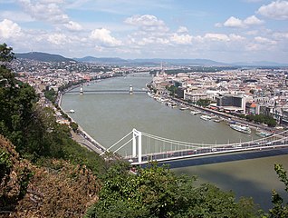
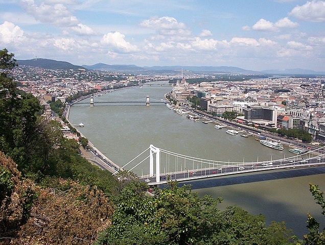
| Sharaxaad | The Hungarian capital city of Budapest, from Gellért Hill. Approximate elevation: 160 m. |
| Taariikhda | 12:53+02 (Europe/Budapest) |
| Xigasho | Shaqadayda |
| Qoraa | Gabor Eszes (UED77) |
| Ogolaasho (Dib u isticmaalka faylkaan) |
Use it freely. |
| Camera location | | View this and other nearby images on: OpenStreetMap |
|---|
I, the copyright holder of this work, hereby publish it under the following licenses:

|
Permission is granted to copy, distribute and/or modify this document under the terms of the GNU Free Documentation License, Version 1.2 or any later version published by the Free Software Foundation; with no Invariant Sections, no Front-Cover Texts, and no Back-Cover Texts. A copy of the license is included in the section entitled GNU Free Documentation License. |
| This file is licensed under the Creative Commons Attribution-Share Alike 3.0 Unported license. | ||
| ||
| This licensing tag was added to this file as part of the GFDL licensing update. |
This file is licensed under the Creative Commons Attribution-Share Alike 2.5 Generic, 2.0 Generic and 1.0 Generic license.
- Waad fasaxantahay:
- la wadaagid – koobi gareenta, qaybinta iyo gudbinta shaqada
- to remix – in shaqada la waafajiyo
- Shuruudaha soo socda:
- Astaan – You must give appropriate credit, provide a link to the license, and indicate if changes were made. You may do so in any reasonable manner, but not in any way that suggests the licensor endorses you or your use.
- si isku mid la wadaag – If you remix, transform, or build upon the material, you must distribute your contributions under the same or compatible license as the original.
You may select the license of your choice.
|
Taariikhda faylka
Riix taariikhda/waqtiga si aad u argto faylka sida oo ahaa markiisa hore.
| Taariikhda/Waqtiga | Sawir yar | Cabirka | Isticmaale | Ka hadalka | |
|---|---|---|---|---|---|
| kan hadda | 03:52, 3 Jannaayo 2006 | | 1,632 × 1,232 (374 KB) | UED77 | {{Information |Description =The Hungarian capital city of Budapest, from Gellért Hill. Taken from approximately 47°29′16.13″ N 19°02′49.20″ E, facing approximately 350°. Approximate elevation: 160 m. |Source =Own work. |Date =2004-07-13 12:53+ |
Faylka lagu isticmaalay
waxyaabaha soo socda ee bog ayaa adeegsanaya faylkaan:
isticmaalka faylka aduunka
Wikisyada kale ee soosocda ayaa adeegsanaya faylka:
- Ku isticmaal ang.wikipedia.org
- Ku isticmaal an.wikipedia.org
- Ku isticmaal arz.wikipedia.org
- Ku isticmaal ast.wikipedia.org
- Ku isticmaal av.wikipedia.org
- Ku isticmaal az.wikipedia.org
- Ku isticmaal ba.wikipedia.org
- Ku isticmaal be.wikipedia.org
- Ku isticmaal br.wikipedia.org
- Ku isticmaal ca.wikipedia.org
- Ku isticmaal ceb.wikipedia.org
- Ku isticmaal ce.wikipedia.org
- Ku isticmaal crh.wikipedia.org
- Ku isticmaal cs.wikipedia.org
- Ku isticmaal cv.wikipedia.org
- Ku isticmaal cy.wikipedia.org
- Ku isticmaal da.wikipedia.org
- Ku isticmaal de.wikipedia.org
- Ku isticmaal diq.wikipedia.org
- Ku isticmaal el.wikipedia.org
- Ku isticmaal en.wikipedia.org
- Ku isticmaal en.wikivoyage.org
- Ku isticmaal es.wikipedia.org
- Ku isticmaal eu.wikipedia.org
- Ku isticmaal fi.wikipedia.org
- Ku isticmaal fr.wiktionary.org
- Ku isticmaal ga.wikipedia.org
- Ku isticmaal gl.wikipedia.org
- Ku isticmaal he.wikipedia.org
- Ku isticmaal hr.wikipedia.org
- Ku isticmaal ia.wikipedia.org
- Ku isticmaal incubator.wikimedia.org
- Ku isticmaal inh.wikipedia.org
- Ku isticmaal io.wikipedia.org
- Ku isticmaal is.wikipedia.org
- Ku isticmaal it.wikipedia.org
- Ku isticmaal ja.wikipedia.org
View more global usage of this file.