
File:China Hong Kong 4 levels localisation.svg

Size of this PNG preview of this SVG file: 705 × 599 pixels. Waxyaabaha kale xalinta: 282 × 240 pixels | 565 × 480 pixels | 904 × 768 pixels | 1,205 × 1,024 pixels | 2,409 × 2,048 pixels | 1,000 × 850 pixels.
Faylka asalka ah (SVG file, nominally 1,000 × 850 pixels, file size: 703 KB)
| Sharaxaad |
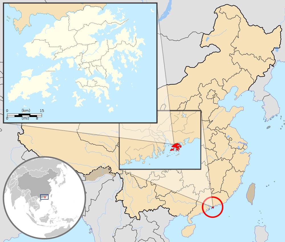
English: Map showing Hong Kong's location in Asia, on China's south coast, and Hong Kong's 18 districts
Français : Carte de Hong Kong : situation en Asie, situation sur le littoral chinois, carte des 18 districts
中文(繁體):顯示香港在亞洲,中國南海岸和香港18區的位置的地圖 |
| Taariikhda | (UTC) |
| Xigasho |
This W3C-unspecified vector image was created with Inkscape . |
| Qoraa |
|
| Other versions | Derivative works of this file: Hebao island map.jpg |
| This is a retouched picture, which means that it has been digitally altered from its original version. Modifications: Combination, color correction. The original can be viewed here: China Hong Kong.svg:
|
This file is licensed under the Creative Commons Attribution-Share Alike 3.0 Unported license.
Attribution: GFDL
- Waad fasaxantahay:
- la wadaagid – koobi gareenta, qaybinta iyo gudbinta shaqada
- to remix – in shaqada la waafajiyo
- Shuruudaha soo socda:
- Astaan – You must give appropriate credit, provide a link to the license, and indicate if changes were made. You may do so in any reasonable manner, but not in any way that suggests the licensor endorses you or your use.
- si isku mid la wadaag – If you remix, transform, or build upon the material, you must distribute your contributions under the same or compatible license as the original.
Original upload log
This image is a derivative work of the following images:
- File:Hong_Kong_Location.svg licensed with PD-self
- 2008-08-27T13:27:11Z Joowwww 1270x640 (234741 Bytes) a few minor tweaks
- 2008-08-27T13:18:03Z Joowwww 1270x640 (234389 Bytes) new version: more detailed, colours are standard with most other locator maps
- 2008-04-20T13:54:51Z Joowwww 1270x640 (79729 Bytes) reduced height, removed map border and added rivers and hk's maritime border
- 2008-04-09T11:31:22Z Joowwww 1270x977 (66085 Bytes) {{Information |Description=A map showing Hong Kong's location in Asia, in China and on China's south coast. |Source=self-made |Date=2008-04-09 |Author= [[User:Joowwww|Joowwww]] |Permission={{PD-self}} |other_versions= }} {{Cr
- File:Map_of_Hong_Kong_18Districts_ZH.svg licensed with Cc-by-sa-3.0, GFDL
- 2008-07-05T21:14:26Z Moddlyg 1454x1083 (381097 Bytes) == Summary == {{Information |Description={{en|1=Map of Hong Kong & 18 Districts (Chinese Version)}} |Source=Own work by uploader |Author={{User:Moddlyg/Sign}} |Date=2008/7/6 |Permission= |other_versions= }} {{ImageUpload|ful
- 2008-07-05T20:59:35Z Moddlyg 1454x1083 (262750 Bytes) {{Information |Description={{en|1=Map of Hong Kong & 18 Districts (Chinese Version)}} |Source=Own work by uploader |Author=~~~ |Date=2008/7/6 |Permission= |other_versions= }}
- File:China_Hong_Kong.svg licensed with PD-self
- 2008-08-13T16:22:08Z Joowwww 1000x850 (212124 Bytes) added missing laos/vietnam border
- 2008-05-14T11:14:46Z Joowwww 1000x850 (210515 Bytes) {{Information |Description=An SVG map of China with Hong Kong special administrative region highlighted and circled Legend:[[Image:China map legend.png]] |Source=self-made; based on CIA public domain maps: *http://www.lib.ut
Uploaded with derivativeFX
Taariikhda faylka
Riix taariikhda/waqtiga si aad u argto faylka sida oo ahaa markiisa hore.
| Taariikhda/Waqtiga | Sawir yar | Cabirka | Isticmaale | Ka hadalka | |
|---|---|---|---|---|---|
| kan hadda | 21:33, 22 Sebteembar 2019 | | 1,000 × 850 (703 KB) | En rouge | added map scale, for the higher resolution sub-picture |
| 07:57, 14 Mey 2015 |  | 1,000 × 850 (686 KB) | Flappiefh | Fixed colour of Haïnan. | |
| 18:40, 5 Maaj 2010 |  | 1,000 × 850 (685 KB) | Pethrus | {{Information |Description={{en|1=Map showing Hong Kong's location in Asia, on China's south coast, and Hong Kong's 18 disctricts}} {{fr|1=Carte de Hong Kong : situation en Asie, situation sur le littoral chinois, carte des 18 disctricts}} |Source=*[[:Fil |
Faylka lagu isticmaalay
waxyaabaha soo socda ee bog ayaa adeegsanaya faylkaan:
isticmaalka faylka aduunka
Wikisyada kale ee soosocda ayaa adeegsanaya faylka:
- Ku isticmaal ami.wikipedia.org
- Ku isticmaal as.wikipedia.org
- Ku isticmaal azb.wikipedia.org
- Ku isticmaal bh.wikipedia.org
- Ku isticmaal bo.wikipedia.org
- Ku isticmaal br.wikipedia.org
- Ku isticmaal cbk-zam.wikipedia.org
- Ku isticmaal dty.wikipedia.org
- Ku isticmaal dz.wikipedia.org
- Ku isticmaal en.wikipedia.org
- Ku isticmaal fi.wikipedia.org
- Ku isticmaal fr.wikipedia.org
- Ku isticmaal fr.wikinews.org
- Ku isticmaal fr.wiktionary.org
- Ku isticmaal fur.wikipedia.org
- Ku isticmaal gcr.wikipedia.org
- Ku isticmaal gn.wikipedia.org
- Ku isticmaal incubator.wikimedia.org
- Ku isticmaal io.wikipedia.org
- Ku isticmaal it.wikipedia.org
- Ku isticmaal ja.wikipedia.org
- Ku isticmaal li.wikipedia.org
- Ku isticmaal lld.wikipedia.org
- Ku isticmaal lo.wikipedia.org
- Ku isticmaal mad.wikipedia.org
- Ku isticmaal mai.wikipedia.org
View more global usage of this file.