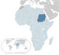
File:Location Sudan before 2011 AU Africa.svg

Size of this PNG preview of this SVG file: 646 × 600 pixels. Waxyaabaha kale xalinta: 258 × 240 pixels | 517 × 480 pixels | 827 × 768 pixels | 1,103 × 1,024 pixels | 2,206 × 2,048 pixels | 1,400 × 1,300 pixels.
Faylka asalka ah (SVG file, nominally 1,400 × 1,300 pixels, file size: 2.17 MB)
Taariikhda faylka
Riix taariikhda/waqtiga si aad u argto faylka sida oo ahaa markiisa hore.
| Taariikhda/Waqtiga | Sawir yar | Cabirka | Isticmaale | Ka hadalka | |
|---|---|---|---|---|---|
| kan hadda | 04:43, 17 Febraayo 2017 |  | 1,400 × 1,300 (2.17 MB) | Chipmunkdavis | Updating Morocco |
| 00:50, 19 Jannaayo 2017 |  | 1,400 × 1,300 (2.17 MB) | Chipmunkdavis | Requesting a move back to the original title, as it is part of a map series. | |
| 02:12, 1 Luuliyo ama Luulyo 2016 |  | 1,400 × 1,300 (2.17 MB) | Raymond1922A | The title explicitly says that this is a map of Sudan before 2011, meaning before South Sudan broke off. | |
| 17:28, 14 Sebteembar 2015 |  | 1,400 × 1,300 (2.17 MB) | Runab | Reverted to version as of 03:46, 10 June 2013 | |
| 23:58, 11 Juun 2013 |  | 1,400 × 1,300 (2.17 MB) | Raymond1922A | Reverted to version as of 14:48, 28 July 2009 | |
| 03:46, 10 Juun 2013 |  | 1,400 × 1,300 (2.17 MB) | Raymond1922A | Same for the world map in the bottom left. | |
| 03:41, 10 Juun 2013 |  | 1,400 × 1,300 (2.17 MB) | Raymond1922A | Added South Sudan as a separate country. | |
| 14:48, 28 Luuliyo ama Luulyo 2009 |  | 1,400 × 1,300 (2.17 MB) | Alvaro1984 18 | {{Information |Description={{en|1=Map of Sudan}} {{es|1=Mapa de Sudán}} |Source=trabajo propio (own work) |Author=Alvaro1984 18 |Date=30/07/2009 |Permission= |other_versions= }} Category:Location maps of Africa [[Category:Suda |
Faylka lagu isticmaalay
waxyaabaha soo socda ee bog ayaa adeegsanaya faylkaan:
isticmaalka faylka aduunka
Wikisyada kale ee soosocda ayaa adeegsanaya faylka:
- Ku isticmaal af.wikipedia.org
- Ku isticmaal az.wikipedia.org
- Ku isticmaal bg.wikipedia.org
- Ku isticmaal ca.wikipedia.org
- Ku isticmaal en.wikipedia.org
- Ku isticmaal en.wiktionary.org
- Ku isticmaal fi.wikipedia.org
- Ku isticmaal fr.wikipedia.org
- Ku isticmaal ha.wikipedia.org
- Ku isticmaal hi.wikipedia.org
- Ku isticmaal id.wikipedia.org
- Ku isticmaal ilo.wikipedia.org
- Ku isticmaal ja.wikipedia.org
- Ku isticmaal km.wikipedia.org
- Ku isticmaal lv.wikipedia.org
- Ku isticmaal my.wikipedia.org
- Ku isticmaal ne.wikipedia.org
- Ku isticmaal pnb.wikipedia.org
- Ku isticmaal simple.wikipedia.org
- Ku isticmaal si.wikipedia.org
- Ku isticmaal smn.wikipedia.org
- Ku isticmaal sr.wikipedia.org
- Ku isticmaal ur.wikipedia.org
