
File:World Scale from DMA Series 1150 map.png
Cabirka muuqaalkaan: 800 × 216 pixels. Waxyaabaha kale xalinta: 320 × 86 pixels | 640 × 173 pixels | 1,024 × 276 pixels | 3,301 × 890 pixels.
Faylka asalka ah (3,301 × 890 pixels, weyninka faylka : 14 KB, nuuca MIME: image/png)

|
This graph image could be re-created using vector graphics as an SVG file. This has several advantages; see Commons:Media for cleanup for more information. If an SVG form of this image is available, please upload it and afterwards replace this template with
{{vector version available|new image name}}.
It is recommended to name the SVG file “World Scale from DMA Series 1150 map.svg”—then the template Vector version available (or Vva) does not need the new image name parameter. |
Qoraal kooban
| Sharaxaad |
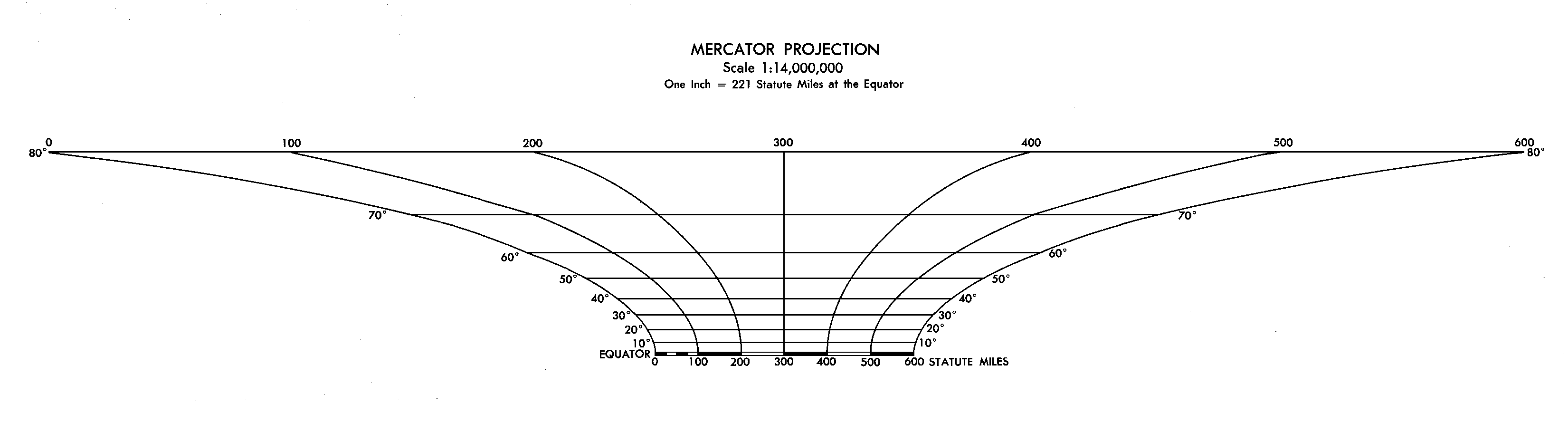
English: The graphical scale from a DMA (now NGA) world map using the Mercator projection. The original map, in six pieces, measures 116 x 86 inches (2.9 x 2.2m). Simplified and reduced size on second try. |
| Taariikhda | |
| Xigasho | Scan of Defense Mapping Agency World Map, series 1150 |
| Qoraa | DMA |
Laysinka
This work is in the public domain in the United States because it is a work prepared by an officer or employee of the United States Government as part of that person’s official duties under the terms of Title 17, Chapter 1, Section 105 of the US Code.
Note: This only applies to original works of the Federal Government and not to the work of any individual U.S. state, territory, commonwealth, county, municipality, or any other subdivision. This template also does not apply to postage stamp designs published by the United States Postal Service since 1978. (See § 313.6(C)(1) of Compendium of U.S. Copyright Office Practices). It also does not apply to certain US coins; see The US Mint Terms of Use.
|
 | |
| This file has been identified as being free of known restrictions under copyright law, including all related and neighboring rights. | ||
Taariikhda faylka
Riix taariikhda/waqtiga si aad u argto faylka sida oo ahaa markiisa hore.
| Taariikhda/Waqtiga | Sawir yar | Cabirka | Isticmaale | Ka hadalka | |
|---|---|---|---|---|---|
| kan hadda | 16:23, 1 Jannaayo 2010 | 3,301 × 890 (14 KB) | Jameslwoodward | ||
| 22:06, 31 Diseembar 2009 |  | 3,301 × 1,733 (33 KB) | Jameslwoodward | {{Information |Description={{en|1=The graphical scale from a DMA (now NGA) world map. The original map, in six pieces, measures 116 x 86 inches (2.9 x 2.2m)}} |Source=Scan of Defense Mapping Agency World Map, series 1150 |Author=DMA |Date=1987 |Permissio |
Faylka lagu isticmaalay
waxyaabaha soo socda ee bog ayaa adeegsanaya faylkaan:
isticmaalka faylka aduunka
Wikisyada kale ee soosocda ayaa adeegsanaya faylka:
- Ku isticmaal ca.wikipedia.org
- Ku isticmaal cs.wikipedia.org
- Ku isticmaal de.wikipedia.org
- Ku isticmaal en.wikipedia.org
- Ku isticmaal es.wikipedia.org
- Ku isticmaal es.wikibooks.org
- Ku isticmaal pt.wikipedia.org
- Ku isticmaal ro.wikipedia.org
- Ku isticmaal sr.wikipedia.org
- Ku isticmaal www.wikidata.org