File:Location Luxembourg EU Europe.png

Page contents not supported in other languages.
Ka Wikipedia

Faylka asalka ah(2,056 × 1,710 pixels, weyninka faylka : 145 KB, nuuca MIME: image/png)

Faylkaan wuxuu ka socdaa Wikimedia Commons waxaana adeegsan kara mashaariic kale. Sharaxaadda ku taal boggeeda faylka ee bogga sharaxaadda faylka halkan hoose ayaa lagu muujiyey.

File:EU-Luxembourg.svg is a vector version of this file. It should be used in place of this PNG file when not inferior.

File:Location Luxembourg EU Europe.png → File:EU-Luxembourg.svg

For more information, see Help:SVG.

In other languages
Alemannisch  Bahasa Indonesia  Bahasa Melayu  British English  català  čeština  dansk  Deutsch  eesti  English  español  Esperanto  euskara  français  Frysk  galego  hrvatski  Ido  italiano  lietuvių  magyar  Nederlands  norsk bokmål  norsk nynorsk  occitan  Plattdüütsch  polski  português  português do Brasil  română  Scots  sicilianu  slovenčina  slovenščina  suomi  svenska  Tiếng Việt  Türkçe  vèneto  Ελληνικά  беларуская (тарашкевіца)  български  македонски  нохчийн  русский  српски / srpski  татарча/tatarça  українська  ქართული  հայերեն  বাংলা  தமிழ்  മലയാളം  ไทย  한국어  日本語  简体中文  繁體中文  עברית  العربية  فارسی  +/−
New SVG image

Qoraal kooban

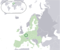
Sharaxaad Location map: Luxembourg (dark green) / European Union (light green) / Europe (dark grey); inspired by and consistent with general country locator maps by User:Vardion, et al.
Taariikhda
Xigasho Shaqadayda
Qoraa Quizimodo

Laysinka

Public domain This work has been released into the public domain by its author, I, Quizimodo. This applies worldwide.
In some countries this may not be legally possible; if so:
I, Quizimodo grants anyone the right to use this work for any purpose, without any conditions, unless such conditions are required by law.

Captions

Add a one-line explanation of what this file represents

Items portrayed in this file

depicts Ingiriisi

inception Ingiriisi

17 Juun 2007

Taariikhda faylka

Riix taariikhda/waqtiga si aad u argto faylka sida oo ahaa markiisa hore.

Taariikhda/WaqtigaSawir yarCabirkaIsticmaaleKa hadalka
kan hadda23:50, 11 Luuliyo ama Luulyo 2020Sawirka yar nuuciisa ahaa 23:50, 11 Luuliyo ama Luulyo 20202,056 × 1,710 (145 KB)De728631added South Sudan to World map
21:58, 11 Luuliyo ama Luulyo 2020Sawirka yar nuuciisa ahaa 21:58, 11 Luuliyo ama Luulyo 20202,056 × 1,710 (145 KB)De728631Brexit update
01:11, 18 Juun 2007Sawirka yar nuuciisa ahaa 01:11, 18 Juun 20072,056 × 1,710 (177 KB)Quizimodo~commonswikiimage (updated)
09:46, 17 Juun 2007Sawirka yar nuuciisa ahaa 09:46, 17 Juun 20072,056 × 1,710 (228 KB)Quizimodo~commonswikiimage (tweaked)
08:28, 17 Juun 2007Sawirka yar nuuciisa ahaa 08:28, 17 Juun 20072,056 × 1,710 (229 KB)Quizimodo~commonswiki{{Information |Description=Location map: Luxembourg (dark green) / European Union (light green) / Europe (dark grey); inspired by and consistent with general country locator maps by User:Vardion, et al |Source=self-made |Date=17 June 2007 |Author= [[User:

Ma jiraan bogag adeegsanaya faylkaan.

Metadata