
File:Americas (orthographic projection).svg

Size of this PNG preview of this SVG file: 550 × 550 pixels. Waxyaabaha kale xalinta: 240 × 240 pixels | 480 × 480 pixels | 768 × 768 pixels | 1,024 × 1,024 pixels | 2,048 × 2,048 pixels.
Faylka asalka ah (SVG file, nominally 550 × 550 pixels, file size: 332 KB)
Qoraal kooban
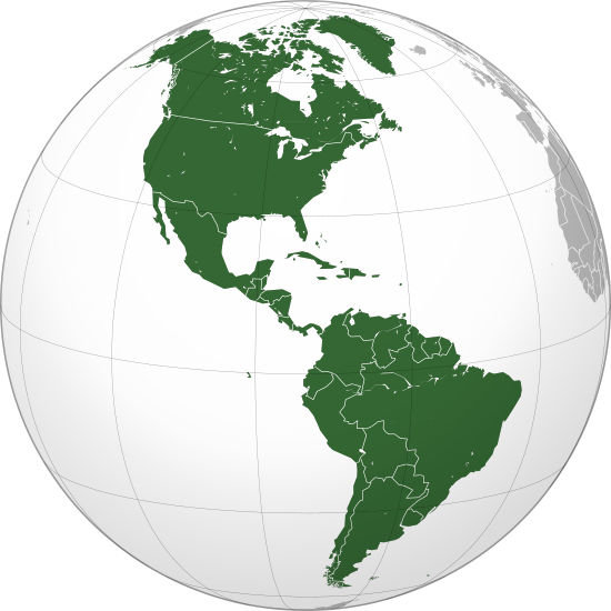
| Sharaxaad | Orthographic map of the Americas with national borders added |
| Taariikhda | |
| Xigasho | Shaqadayda |
| Qoraa | Martin23230 |
| Other versions |
.svg) |
| SVG genesis |
.svg)
.svg)
.svg)
.svg)
.svg)
.svg)
.svg)
.svg)
.svg)
.svg)
.svg)
.svg)
.svg)
.svg)
.svg)
.svg)
.svg)
.svg)
.svg)
.svg)
.svg)
.svg)
.svg)
.svg)
.svg)
.svg)
.svg)
.svg)
.svg)
.svg)
.svg)
.svg)
.svg)
.svg)
.svg)
.svg)
.svg)
.svg)
.svg)
.svg)
.svg)
.svg)
.svg)
.svg)
.svg)
.svg)
.svg)
.svg)
.svg)
.svg)
.svg)
.svg)
.svg)
.svg)
.svg)
.svg)
.svg)
.svg)
.svg)
.svg)
.svg)
.svg)
.svg)
.svg)
.svg)
.svg)
.svg)
.svg)
.svg)
.svg)
.svg)
.svg)
.svg)

.svg)

.svg)

.svg)
.svg)
.svg)
.svg)
.svg)
.svg)
.svg)


.svg)
.svg)
.svg)
.svg)
.svg)
.svg)
.svg)

.svg)
.svg)
.svg)
.svg)
.svg)
.svg)
.svg)
.svg)
.svg)

.svg)
.svg)
.svg)
.svg)
.svg)
.svg)
.svg)
_without_national_boundaries.svg)
.svg)
.svg)
.svg)
.svg)
.svg)
.svg)

.svg)
.svg)
.png)
.svg)
.svg)
.svg)
.svg)

.svg)
.svg)
.svg)
.svg)
.svg)
.svg)
.svg)
.svg)
.svg)
.svg)
.svg)

.svg)
.svg)
.svg)
.svg)
.svg)
.svg)
.svg)
.svg)
.svg)

.svg)
.svg)

.svg)
.svg)
.svg)
.svg)
.svg)
.svg)
.svg)
.svg)
.svg)
.svg)
.svg)
.svg)
.svg)
.svg)
.svg)
.svg)
.svg)
.svg)
.svg)
.svg)
.svg)
.svg)
.svg)
.svg)
.svg)
.svg)
.svg)
_-_Crimea_disputed.svg)
.svg)
.svg)
.svg)
.svg)
.svg)
.svg)
.svg)
.svg)
.svg)
.svg)
.svg)
_political.svg)
.svg)
.svg)
.svg)
.svg)
_-_Crimea_disputed_-_no_borders.svg)
.svg)
.svg)
.svg)
.svg)
.svg)
.svg)
.svg)
.svg)
.svg)
.svg)
.svg)

.svg)
.svg)
.svg)

.png)
.svg)
.svg)
.svg)
.svg)
.svg)
.svg)
.svg)
.svg)
.svg)
.svg)
.svg)
.svg)
.svg)
.svg)
.svg)
.svg)
.svg)
.svg)
.svg)
.svg)
.svg)
.svg)
.svg)
.svg)
.svg)
.svg)
.svg)
.svg)
.svg)
.svg)
.svg)
.svg)
.svg)
.svg)
.png)
.svg)
.svg)
.svg)
_(orthographic_projection).png)
.svg)
Laysinka
I, the copyright holder of this work, hereby publish it under the following licenses:
This file is licensed under the Creative Commons Attribution-Share Alike 3.0 Unported license.
- Waad fasaxantahay:
- la wadaagid – koobi gareenta, qaybinta iyo gudbinta shaqada
- to remix – in shaqada la waafajiyo
- Shuruudaha soo socda:
- Astaan – You must give appropriate credit, provide a link to the license, and indicate if changes were made. You may do so in any reasonable manner, but not in any way that suggests the licensor endorses you or your use.
- si isku mid la wadaag – If you remix, transform, or build upon the material, you must distribute your contributions under the same or compatible license as the original.

|
Permission is granted to copy, distribute and/or modify this document under the terms of the GNU Free Documentation License, Version 1.2 or any later version published by the Free Software Foundation; with no Invariant Sections, no Front-Cover Texts, and no Back-Cover Texts. A copy of the license is included in the section entitled GNU Free Documentation License. |
You may select the license of your choice.
Taariikhda faylka
Riix taariikhda/waqtiga si aad u argto faylka sida oo ahaa markiisa hore.
| Taariikhda/Waqtiga | Sawir yar | Cabirka | Isticmaale | Ka hadalka | |
|---|---|---|---|---|---|
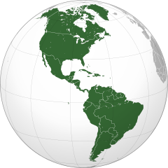
| kan hadda | 22:24, 18 Luuliyo ama Luulyo 2016 | | 550 × 550 (332 KB) | Turnless | Reverted to version as of 04:48, 5 December 2009 (UTC) Hawaii is in Oceania |
| 02:05, 30 Abriil 2013 |  | 550 × 550 (1.44 MB) | Giggette | Centered | |
| 04:48, 5 Diseembar 2009 |  | 550 × 550 (332 KB) | Keepscases | borders | |
| 11:26, 16 Agoosto 2009 |  | 541 × 541 (332 KB) | Bosonic dressing | tweak map: colour St. Lawrence Island (Alaska, USA), draw in missing peripheral latitudinal lines | |
| 16:20, 26 Juun 2009 |  | 541 × 541 (318 KB) | Martin23230 | {{Information |Description= Orthographic map of the Americas |Source=self-made |Date=2009-06-26 |Author= Martin23230 |Permission= |other_versions= }} Category:Orthographic projections Category:Maps of the Americas |
Faylka lagu isticmaalay
waxyaabaha soo socda ee bog ayaa adeegsanaya faylkaan:
isticmaalka faylka aduunka
Wikisyada kale ee soosocda ayaa adeegsanaya faylka:
- Ku isticmaal ab.wikipedia.org
- Ku isticmaal af.wikipedia.org
- Ku isticmaal am.wikipedia.org
- Ku isticmaal an.wikipedia.org
- Ku isticmaal ar.wikipedia.org
- الولايات المتحدة
- عالم غربي
- هندوراس
- فنزويلا
- شعراء المهجر
- آسيا
- أوروبا
- قارة
- تصنيف:قارات
- المكسيك
- كندا
- الأرجنتين
- تصنيف:كوبا
- تصنيف:أمريكا الشمالية
- سيمون بوليفار
- برمودا
- تصنيف:أمريكا الجنوبية
- تصنيف:أرجنتينيون
- المحيط الهادئ
- أستراليا
- القارة القطبية الجنوبية
- كوبا
- بليز
- تصنيف:دول أمريكا
- تصنيف:مدن أمريكية
- اللغة الإسبانية
- تصنيف:دول الكاريبي
- أوقيانوسيا
- تصنيف:أنهار أمريكا الجنوبية
- بوليفيا
- بيرو
- حضارة المايا
View more global usage of this file.
.svg)
.svg)