
File:Chad location map.svg

Size of this PNG preview of this SVG file: 399 × 599 pixels. Waxyaabaha kale xalinta: 160 × 240 pixels | 320 × 480 pixels | 512 × 768 pixels | 682 × 1,024 pixels | 1,365 × 2,048 pixels | 899 × 1,349 pixels.
Faylka asalka ah (SVG file, nominally 899 × 1,349 pixels, file size: 294 KB)
Qoraal kooban
| Camera location | | View this and other nearby images on: OpenStreetMap |
|---|
| Sharaxaad |
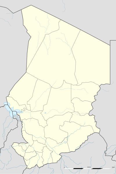
English: Blank administrative map of Chad as since the 2008-02 reform of the Regions, for geo-location purposes.
Français : Carte administrative vierge du Tchad telle que depuis la réforme des Régions de février 2008, destinée à la géolocalisation. Scale: 1:5,600,000 (precision: 1,400 m)
Geographic limits of the map:
|
||
| Taariikhda | 2009-11, updated 2011-07 | ||
| Xigasho |
Shaqadayda
|
||
| Qoraa | Eric Gaba (Sting - fr:Sting) | ||
| Ogolaasho (Dib u isticmaalka faylkaan) |
|
||
| Other versions |
|

Laysinka
I, the copyright holder of this work, hereby publish it under the following licenses:
This file is licensed under the Creative Commons Attribution-Share Alike 3.0 Unported license.
- Waad fasaxantahay:
- la wadaagid – koobi gareenta, qaybinta iyo gudbinta shaqada
- to remix – in shaqada la waafajiyo
- Shuruudaha soo socda:
- Astaan – You must give appropriate credit, provide a link to the license, and indicate if changes were made. You may do so in any reasonable manner, but not in any way that suggests the licensor endorses you or your use.
- si isku mid la wadaag – If you remix, transform, or build upon the material, you must distribute your contributions under the same or compatible license as the original.

|
Permission is granted to copy, distribute and/or modify this document under the terms of the GNU Free Documentation License, Version 1.2 or any later version published by the Free Software Foundation; with no Invariant Sections, no Front-Cover Texts, and no Back-Cover Texts. A copy of the license is included in the section entitled GNU Free Documentation License. |
You may select the license of your choice.
Taariikhda faylka
Riix taariikhda/waqtiga si aad u argto faylka sida oo ahaa markiisa hore.
| Taariikhda/Waqtiga | Sawir yar | Cabirka | Isticmaale | Ka hadalka | |
|---|---|---|---|---|---|
| kan hadda | 22:26, 14 Luuliyo ama Luulyo 2011 | | 899 × 1,349 (294 KB) | Sting | Sudan/South Sudan 2011-07 border update |
| 23:28, 23 Nofeembar 2009 |  | 899 × 1,349 (268 KB) | Sting | == {{int:filedesc}} == {{Location|15|27|00|N|18|43|30|E|scale:7000000}} <br/> {{Information |Description={{en|Blank administrative map of Chad as after the 2008-02 reform of the Regions, for geo-location purposes.}} {{fr|Carte administrative |
Faylka lagu isticmaalay
waxyaabaha soo socda ee bog ayaa adeegsanaya faylkaan:
isticmaalka faylka aduunka
Wikisyada kale ee soosocda ayaa adeegsanaya faylka:
- Ku isticmaal af.wikipedia.org
- Ku isticmaal am.wikipedia.org
- Ku isticmaal ar.wikipedia.org
- Ku isticmaal az.wikipedia.org
- Ku isticmaal ba.wikipedia.org
- Ku isticmaal be-tarask.wikipedia.org
- Ku isticmaal be.wikipedia.org
- Ku isticmaal bg.wikipedia.org
- Ku isticmaal bn.wikipedia.org
- Ku isticmaal bs.wikipedia.org
- Ku isticmaal ceb.wikipedia.org
View more global usage of this file.