
File:Chichen Itza ruins in Mexico -- by John Romkey.jpg

Cabirka muuqaalkaan: 800 × 600 pixels. Waxyaabaha kale xalinta: 320 × 240 pixels | 640 × 480 pixels | 1,024 × 768 pixels | 1,280 × 960 pixels | 2,272 × 1,704 pixels.
Faylka asalka ah (2,272 × 1,704 pixels, weyninka faylka : 1.27 MB, nuuca MIME: image/jpeg)
Qoraal kooban
| Sharaxaad |
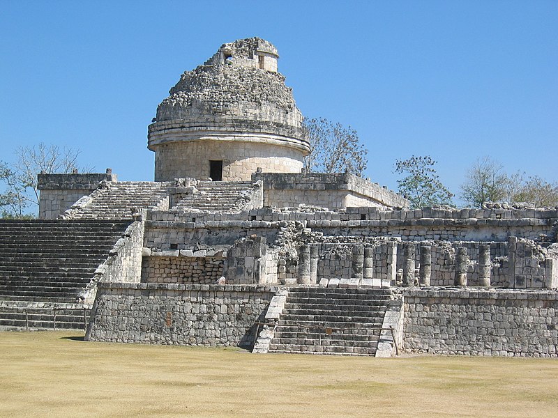
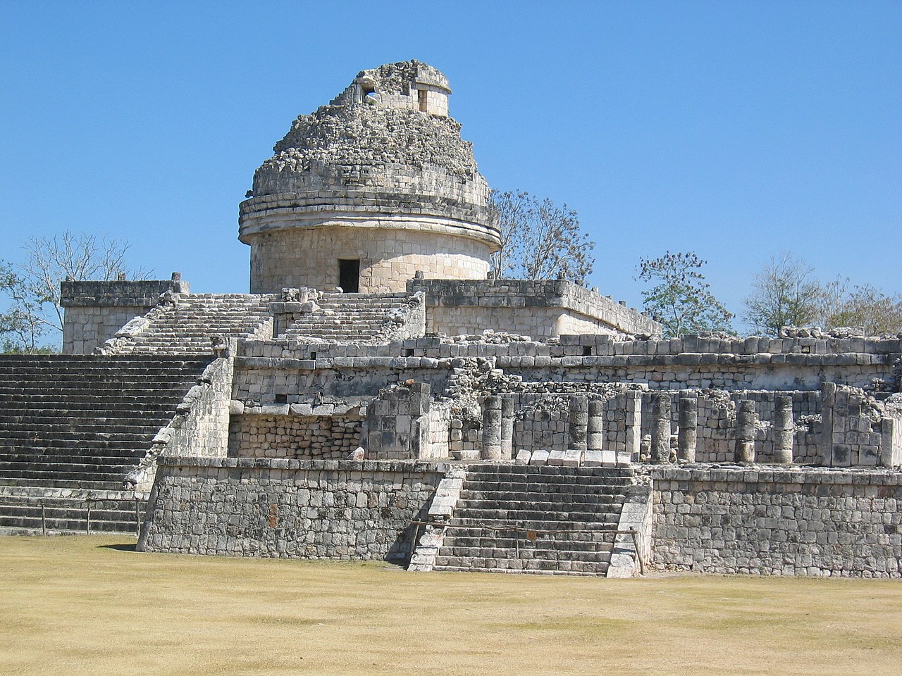
English: This is the structure called "The Observatory" in the Chichen Itza ruins in Mexico. Chichen Itza ruins in Mexico |
| Taariikhda | |
| Xigasho | Flickr |
| Qoraa | John Romkey from USA |
| Reviewer | Fruggo |
| Camera location | | View this and other nearby images on: OpenStreetMap |
|---|
Laysinka
 |
When this file was uploaded to Wikimedia Commons, it was available from Flickr under the stated license. The Flickr user has since stopped distributing the file under this license. As Creative Commons licenses cannot be revoked in this manner, the file is still free to use under the terms of the license specified. See the Creative Commons FAQ on revoking licensing.
|
This file is licensed under the Creative Commons Attribution 2.0 Generic license.
- Waad fasaxantahay:
- la wadaagid – koobi gareenta, qaybinta iyo gudbinta shaqada
- to remix – in shaqada la waafajiyo
- Shuruudaha soo socda:
- Astaan – You must give appropriate credit, provide a link to the license, and indicate if changes were made. You may do so in any reasonable manner, but not in any way that suggests the licensor endorses you or your use.
| This image, originally posted to Flickr, was reviewed on 23 October 2005 (UTC) by the administrator or reviewer FlickrLickr, who confirmed that it was available on Flickr under the stated license on that date. |
Taariikhda faylka
Riix taariikhda/waqtiga si aad u argto faylka sida oo ahaa markiisa hore.
| Taariikhda/Waqtiga | Sawir yar | Cabirka | Isticmaale | Ka hadalka | |
|---|---|---|---|---|---|
| kan hadda | 08:41, 23 Oktoobar 2005 | | 2,272 × 1,704 (1.27 MB) | FlickrLickr | {{flickr| |title=Chichen Itza ruins in Mexico |description=This is the structure called "The Observatory" in the Chichen Itza ruins in Mexico. |photographer=John Romkey |photographer_location=USA |photographer_url=http://flickr.com/photos/34169636@N00 |fl |
Faylka lagu isticmaalay
waxyaabaha soo socda ee bog ayaa adeegsanaya faylkaan:
isticmaalka faylka aduunka
Wikisyada kale ee soosocda ayaa adeegsanaya faylka:
- Ku isticmaal ar.wikipedia.org
- Ku isticmaal be.wikipedia.org
- Ku isticmaal ca.wikipedia.org
- Ku isticmaal en.wikipedia.org
- Ku isticmaal es.wikipedia.org
- Ku isticmaal fa.wikipedia.org
- Ku isticmaal fr.wikipedia.org
- Ku isticmaal fr.wikibooks.org
- Ku isticmaal hu.wikipedia.org
- Ku isticmaal hy.wikipedia.org
- Ku isticmaal id.wikipedia.org
- Ku isticmaal it.wikipedia.org
- Ku isticmaal it.wikivoyage.org
- Ku isticmaal nl.wikipedia.org
- Ku isticmaal pt.wikipedia.org
- Ku isticmaal sh.wikipedia.org
- Ku isticmaal sr.wikipedia.org
- Ku isticmaal vi.wikipedia.org
- Ku isticmaal zh.wikipedia.org